Kathmandu to Everest Base Camp by Road: A Complete Guide to the Solu Region
Every year, tens of thousands of trekkers board a 30-minute turboprop from Kathmandu to Lukla, land at one of the world’s most dangerous airports, and begin their walk toward Everest Base Camp — all without ever seeing the half of Nepal that lies between those two points.
The road route changes entirely.
When you travel from Kathmandu to Everest Base Camp by road — by jeep through the lower hills of Solukhumbu, you don’t skip Nepal’s middle. You live inside it for two full days before a single step of trekking begins. And the region you pass through, the Solu, is one of the most culturally rich and least-visited corridors in the entire Himalaya.
This guide covers everything you need to know: what the Solu region is, who lives there, what you’ll see, how the road journey works, and why it makes your EBC experience significantly deeper than the flight-in alternative.
What Is the Solu Region?
Solukhumbu District — the name says it all — is made up of two distinct sub-regions: Solu in the south and Khumbu in the north. Most travelers only know Khumbu: Namche Bazaar, Tengboche, Lobuche, Base Camp. That is the high-altitude world above 3,400 metres that features in every Everest documentary and travel magazine.

Solu region in the map of Nepal
Solu is the other half. Spanning roughly 1,500 to 3,500 metres in elevation, it is a mid-hill region of dense rhododendron forests, terraced farmland carved into steep hillsides, apple and apricot orchards, glacial rivers, and villages that have remained largely untouched by mass tourism. The district headquarters, Salleri, sits at around 2,270 metres — lower than Namche, quieter than Lukla, and almost entirely unknown to the international trekkers who pass through the region’s northern tip each season.
Who Lives in the Solu Region?
This is where the EBC road route genuinely surprises people. The Solu is not a Sherpa-only world. It is one of Nepal’s most ethnically layered landscapes.

People of the Solu region
Rai communities make up the largest indigenous group in the lower Solu valleys. The Kulung, Khaling, Thulung, Nachhiring, and Bahing Rai peoples are among the original inhabitants of this region, with their own distinct languages, animist-Hindu traditions, and a cultural identity entirely separate from the Sherpa communities of the high mountains. Villages like Jubing, Khari Khola, and sections of the Dudh Koshi valley are predominantly Rai. Walking through them, you encounter a Nepal that has almost nothing in common with the Khumbu tourism corridor — woven bamboo fences, terraced millet fields, stone houses with smoke curling from open hearths.
Related Packages
Everest Base Camp Trek by Road - 16 Days
 5,550m/18,209ft
 Moderate
 All
Inclusive Plan
All
Inclusive Plan
Sherpa communities begin to appear as the trail climbs. But unlike the Khumbu Sherpas who have been reshaped by decades of expedition and trekking business, Solu Sherpas — particularly around Ringmo, Junbesi, and Phaplu — still live primarily as farmers, herders, and orchardists. They are the ancestral Sherpas: people who migrated from eastern Tibet around 450 to 500 years ago and settled these mid-altitude valleys long before Edmund Hillary ever arrived in Nepal. The name Sherpa itself means “people from the east” in Tibetan, and in Solu, you feel that origin story in a way you simply don’t feel it in commercially crowded Namche.
Brahmin, Chhetri, Tamang, and other hill communities round out the population, making Solu one of the most genuinely diverse corridors in eastern Nepal. According to district census data, over 70% of Solukhumbu’s population is Janjati (indigenous nationalities), and more than a dozen distinct languages are spoken across the district. Walking through Salleri and Phaplu on a market day — when farmers from surrounding villages bring potatoes, greens, and livestock down to trade — is an experience that no Lukla flight can offer.
The Road Journey: Kathmandu to Thamdanda
The drive to Everest Base Camp journey begins early on day two, with a private 4WD jeep departing Kathmandu in the pre-dawn hours. The route follows the BP Highway southeast before turning into the increasingly rugged roads of the Solukhumbu hills.
The drive to Salleri takes approximately seven to nine hours, depending on road conditions and stops. It is not a luxury coach ride — the road narrows, the surface roughens, and sections near the Solu region require a proper 4WD. But that is precisely the point. You cross rivers on narrow bridges, pass through market villages that rarely see foreign visitors, wind along ridgelines with sudden views of Makalu and Gauri Shankar, and descend into valleys where the air smells of pine and wood smoke rather than Kathmandu exhaust.
Key stops along the Kathmandu to EBC drive
Dhulikhel — the last major town before the hills begin, with its famous ridge views of the Himalayan chain.
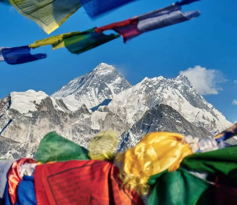
Patale Danda — a viewpoint on the road to Salleri from which, on clear mornings, you can see Everest, Lhotse, and Makalu rising above the foothills. Most trekkers see Everest for the first time from Namche. You’ll see it here, from a moving jeep, two days earlier.
Salleri (Phaplu area) — the district headquarters of Solukhumbu, where you overnight before continuing deeper into the hills. The town has a small but lively local market, a monastery on the hill above, and the quiet rhythm of a place built for Nepali life, not for trekkers.
Thamdanda (Tham Danda) — the road-end trailhead where the trek officially begins, at around 2,500 metres. From here, the path climbs through forest and Rai villages to Paiya and eventually Surke, where it joins the classic EBC route above Lukla.
What You See in the Solu That Khumbu Trekkers Miss
The gradual transition from sub-tropical mid-hills to alpine Himalayan landscape is something that can only be experienced on foot and by road. Here is what trekkers are consistently surprised by the most:
The monasteries of Solu. While Tengboche Monastery gets the fame, the Solu region holds some of the oldest and most serene Buddhist institutions in Nepal. Chiwang Gompa, Thupten Choling Gompa (a major Tibetan Buddhist centre near Junbesi), and Taksindu Gompa, established by monks from Tengboche itself, sit in forested hillsides far from the tourist trail. At Thupten Choling, around 500 monks and nuns are in residence. The chanting you hear from the courtyard is not performed for visitors; it is the daily religious life of a living monastic community.

Chiwong Gompa is a Sherpa monastery at an elevation of 2,800m
The orchards of Ringmo. The village of Ringmo, tucked between rhododendron forest and the Dudh Koshi valley, is famous among those who know the Solu for its apple, peach, and apricot trees. In autumn, the fruit hangs heavy, and the air is sweet. Local women sell dried apricots and homemade raksi (distilled spirits) from their doorsteps. It is the kind of village scene that feels like it belongs to a different century.
The silence of the lower trail. In peak season on the standard Khumbu route, you share the path with hundreds of trekkers per day between Lukla and Namche. On the Solu approach via Thamdanda, Paiya, and Surke, you may walk for three or four hours and meet no other foreign trekker at all. The trail belongs to local porters, yak herders, and the occasional Rai farmer carrying firewood. That silence, after Kathmandu, is striking.
The acclimatization advantage. This is not just about scenery. Starting your ascent from Salleri at around 2,270 metres rather than landing in Lukla at 2,860 metres gives your body a more gradual introduction to altitude. The slow climb through the Solu hills — gaining height progressively over two days of trekking before joining the main EBC trail near Phakding — is simply better physiology. Many trekkers who struggle with altitude sickness after flying to Lukla find the road approach significantly more comfortable.
Altitude Sickness and Why the Road Approach Gives You a Real Advantage?
This is where the road route earns its most important distinction — not just scenically or culturally, but medically.
Altitude sickness, known clinically as Acute Mountain Sickness (AMS), is the single most common reason trekkers fail to reach Everest Base Camp. Not fitness, not weather, not difficult terrain. Studies estimate that around 40–50% of trekkers on the standard EBC route experience some degree of AMS symptoms, and it affects marathon runners and casual walkers equally. The determining factor is not how fit you are. It is how fast you ascend.
Why does flying to Lukla create an immediate altitude problem?
When you fly from Kathmandu at 1,300 metres to Lukla at 2,860 metres in 30 minutes, your body jumps 1,560 metres in altitude with no physiological preparation. You step off a small aircraft already inside the zone where AMS begins — and within 48 hours, most flight-in trekkers are sleeping in Namche Bazaar at 3,440 metres. The mandatory acclimatisation day in Namche is not a bonus rest. It is a medical necessity that exists because the flight gave the body no runway.
What does the road route do differently?
The road approach begins the altitude transition long before the trek starts. You sleep in Kathmandu at 1,300 metres, then overnight in Salleri at around 2,270 metres, then begin trekking from Thamdanda at around 2,500 metres. Look at what that means for your sleeping elevations across the first few days:
| Day | Flight Route | Road Route |
| Day 1 Sleep | 2,860m – Lukla | 1,300m -Kathmandu |
| Day 2 Sleep | 2,610m -Phakding | 2,270m salleri |
| Day 3 Sleep | 3,440m – Namche | 2,500m Thamdanda are |
| First night above 3,000m | Day 3 | Day 5-6 |
| Days spent below 2,500m | 0 | 2 full days |
By the time road-route trekkers reach Phakding and join the standard EBC trail, their bodies have already spent 48–72 hours at moderate elevation. The kidneys have begun producing erythropoietin, which stimulates red blood cell production.
Breathing patterns have started adjusting. The lungs are working more efficiently at reduced oxygen levels. When they arrive in Namche, it is not a shock — it is another step along a gradient that has been building since Salleri.
This matters because the science of acclimatisation is about accumulated altitude exposure. The body cannot be rushed into adaptation; it needs time at intermediate elevations before climbing higher.
Research comparing gradual versus rapid ascent to very high altitude has consistently found that slower ascenders experience less severe drops in blood oxygen saturation, develop fewer AMS symptoms, require less medication, and report a significantly more enjoyable experience than trekkers who ascend quickly.
The three forms of altitude illness — and what to watch for
Acute Mountain Sickness (AMS) is the most common. Symptoms appear within 6–24 hours of reaching a new elevation and include headache, nausea, fatigue, loss of appetite, dizziness, and disrupted sleep. Mild AMS resolves with rest and hydration at the same elevation. The rule that experienced Himalayan guides consider absolute: never ascend with AMS symptoms, not one metre. If symptoms do not resolve within 24 hours or worsen at all, descend.
High Altitude Pulmonary Oedema (HAPE) is serious. Fluid accumulates in the lungs. Signs include persistent dry cough, breathlessness at rest, extreme fatigue, and bluish colouring of the lips or fingertips. HAPE is life-threatening without immediate descent and medical treatment.
High Altitude Cerebral Oedema (HACE) is the most severe form, involving swelling of brain tissue. Signs include a severe headache unresponsive to any medication, loss of coordination, confusion, and deteriorating consciousness. HACE requires emergency evacuation without delay.
HAPE and HACE are rare on a properly paced itinerary. AMS is not. Every trekker should know the difference and be prepared to be honest with their guide about how they are actually feeling.
The altitude checkpoints you need to know
Namche Bazaar: 3,440m. Where most trekkers first experience meaningful symptoms. All EBC itineraries include at least one acclimatisation day here. Use it to hike up to the Everest View Hotel at 3,880m and return to sleep lower — not to rest indoors. The principle is climb high, sleep low: gain elevation during the day to stimulate red blood cell production, return to sleep where your body is more comfortable.
Dingboche: 4,410m. The second mandatory acclimatisation point, where exercise capacity drops noticeably, and sleep becomes more difficult. A hike to Nangkartshang Peak at 5,083m and return is the standard protocol. Road-route trekkers who have acclimatised gradually from lower elevations consistently report feeling stronger here than trekkers who flew in.

Dingboche
Lobuche: 4,940 m. No scheduled acclimatisation day, but this is where poorly acclimatised trekkers most often face serious problems. Pushing through warning signs at Namche or Dingboche frequently catches up at Lobuche.

Lobuche
Gorak Shep: 5,164m. The last village before Base Camp. Altitude headaches here are extremely common, even in well-acclimatised trekkers. This is normal; it does not mean you should ascend further if other AMS symptoms are also present.
Kala Patthar: 5,545m. The highest point of the itinerary is reached early morning before descent. The road route’s acclimatisation head-start shows its most tangible benefit at this elevation, where the margin between a good experience and a miserable one is narrow.
A pulse oximeter is one of the most valuable tools on the trek — a small fingertip device measuring blood oxygen saturation (SpO₂). Healthy values drop with altitude; a sudden drop of more than 5% from your personal baseline warrants serious attention. All reputable EBC operators on the road route include a pulse oximeter as standard equipment.
Diamox (acetazolamide) is a prescription medication that accelerates acclimatisation by stimulating faster breathing and raising blood oxygen levels. The standard preventive dose is 125–250mg twice daily, starting one to two days before high-altitude ascent. Diamox assists the process — it does not replace it. Consult your doctor well before departure.
Hydration is consistently underestimated. Drink at least three to four litres of water per day on the trail. Dehydration worsens every AMS symptom and is one of the most common and avoidable mistakes. Avoid alcohol, particularly during the first days at new elevations.
Travel insurance covering helicopter evacuation from Nepal is non-negotiable. Evacuation from above 4,000 metres regularly costs several thousand US dollars.
Medical resources on the route
The Khumbu region has better high-altitude medical infrastructure than almost any comparable trekking destination in the world. Namche Bazaar has facilities for basic assessment and treatment. The Himalayan Rescue Association Clinic in Pheriche at 4,371 metres is the primary altitude medicine resource on the upper trail, staffed by volunteer physicians specialising in high-altitude illness during the main trekking seasons. On the road route through the Solu, your operator will carry satellite communication equipment for the sections where mobile networks are absent.
Practical Information for the Road Route
What is the best time for the Everest Region Trekking?
March to May (spring) and September to November (autumn). The road to Salleri is impassable during the monsoon season (June to September) due to landslides, and this route should not be attempted outside the dry months.
How long is the Kathmandu to Everest Base Camp trek without the Lukla flight?
A road-based EBC itinerary typically runs 16 to 18 days, compared to 14 days for the flight-based standard route. The extra days are the Solu road and lower trail days — and most trekkers say those were among their favourites.
Permits required: Sagarmatha National Park Entry Permit and the Khumbu Pasang Lhamu Rural Municipality Permit. These are the same permits required for the standard EBC route and are arranged by your trekking agency.
Accommodation: Teahouses are available from Salleri onwards. In the lower Solu villages, lodges are simpler and less commercial than those in Khumbu, which is exactly the point. In Salleri and Phaplu, accommodation is basic but clean. Some trekkers arrange a homestay in a Sherpa family home, which is possible in several Solu villages and provides an entirely different level of cultural immersion.
Transport: A private 4WD jeep is strongly recommended over shared transport for comfort and flexibility. The road is rough in places, and a shared jeep with luggage strapped to the roof is a significantly less pleasant way to spend nine hours than a dedicated vehicle.
Why This Route Belongs in Your Itinerary
The EBC trek by road is not a budget compromise or a contingency plan for when Lukla flights are cancelled. It is a fundamentally richer version of the same journey.
When you arrive at Everest Base Camp after this route, you have not just trekked to the world’s highest base camp. You have crossed two ethnically distinct regions of Nepal on the ground, seen Everest from a roadside viewpoint before most trekkers have even boarded their domestic flight, sat in monasteries that have no tourist infrastructure, eaten food cooked by Rai families in kitchens built into hillsides, and watched the landscape transform from subtropical forest to high alpine moraine over the course of two weeks.
The mountain at the end is the same. Everything leading to it is different.
Ready to plan your Everest Base Camp trek by road? Contact our team for a full itinerary, cost breakdown, and best departure dates for 2026 and 2027.
Can you really travel from Kathmandu to Everest Base Camp by road?
Yes. You can travel from Kathmandu to Everest Base Camp mostly by road up to a certain point. From Kathmandu, the drive goes to Salleri (approx. 268 km, 8–10 hours), and then further by jeep toward Surke or Thamdanda, after which trekking begins.
Where does the road end on the Kathmandu to EBC by road route?
As of early 2026, the road has extended past Salleri and Phaplu, reaching Thamdanda and even near Surke. From here, the road ends, and your boots take over. From Surke (located just below Lukla), you hike for about 4–5 hours to reach Phakding.
How long does the drive from Kathmandu to Thamdanda take?
The driving duration from Kathmandu to Thamdanda typically spans 14 to 16 hours in total. It is highly recommended to split this into two days. The road starts on the smooth, winding BP Highway but transitions into rugged, off-road terrain as you enter the Solukhumbu district. Best Heritage Tour
What is the road condition like on this route?
The road from Kathmandu to Salleri is famous for its hairpin turns. The newly constructed roads can be dusty in the dry season (March–May). The road from Salleri to Thamdanda is seasonal — during the monsoon (June–August), this stretch can be muddy and prone to delays.
Is a jeep or a bus better for the Kathmandu to Salleri drive?
A private or shared jeep is strongly recommended over a bus. The jeep journey can be dusty and physically draining. Keeping a buff or face mask handy for the drive is advisable, as well as a small daypack with snacks and water, as stops along the road are limited. Best Heritage Tour
How many days does the Everest Base Camp trek by road take?
This epic Everest Base Camp trek without flight unfolds over 16 days, covering approximately 700 kilometers of breathtaking landscapes — ascending from Kathmandu (1,400 m) to Everest Base Camp (5,364 m).
What is the typical route itinerary for EBC by road from Kathmandu?
The standard route goes: Kathmandu → Salleri → Thamdanda (by jeep) → Phakding → Namche Bazaar → Tengboche → Dingboche → Lobuche → Gorak Shep → Everest Base Camp → Kala Patthar → return via Thamdanda to Kathmandu. The path through Thamdanda covers the classic trail of the Jiri Everest Base Camp trek route.
What is the Solu region, and which villages will I pass through?
The Everest Himalayas are in the Solukhumbu district, known as the Khumbu region. The lower areas visited overland are known as the Solu region. Key Solu villages include Salleri, Phaplu, Ringmo, Takshindo, Kharikhola, and Paiya — communities that exhibit Rai and Sherpa culture.
How much does the Kathmandu to Everest Base Camp by road cost in 2026?
The Kathmandu to Everest Base Camp by Road package for 2026/2027 ranges from USD 1,499 to USD 1,799 per person, depending on group size, personalization, and services.
What permits are required for the EBC trek by road?
Every trekker needs three permits: a TIMS Card (Trekkers’ Information Management System), a Sagarmatha National Park Entry Permit, and a Khumbu Pasang Lhamu Rural Municipality Permit.
Where can I get the permits for this route?
The Sagarmatha National Park Entry Permit can be arranged in Kathmandu. The Khumbu Pasang Lhamu Rural Municipality Permit is payable on the trail. Most trekking agencies manage all permits as part of the package.
Why should I choose the road route instead of flying to Lukla?
Flying from Kathmandu (1,400 m) to Lukla (2,860 m) in 30 minutes is a shock to the system. Driving allows your body to adjust to altitude shifts more naturally. It is also more cost-efficient, saving hundreds of dollars on domestic airfare, and offers cultural immersion through the lower Solu region villages like Salleri and Phaplu.
How does the road route reduce the risk of altitude sickness?
The EBC trek by road begins at lower altitudes and ascends progressively, reducing the risk of altitude sickness. The journey provides gradual altitude gain and enhanced acclimatization. Haven Holidays Ltd.
Does the road route avoid Lukla airport delays?
Yes. Lukla’s Tenzing-Hillary Airport is notorious for weather-related delays. A single cloud can ground flights for days, throwing an entire itinerary into chaos. The road route eliminates this uncertainty entirely. Best Heritage Tour
How difficult is the Everest Base Camp trek by road?
The Everest Base Camp Trek by Road is challenging but highly rewarding. Practically everyone comfortable carrying some weight while hiking can accept the challenge. The drive itself can also be taxing — the 14-hour drive can be physically draining, so being well-rested before the trek officially begins in Thamdanda is important.
Is the EBC road route suitable for first-time trekkers?
It can be, with proper preparation. The gradual altitude gain actually makes it more beginner-friendly than flying to Lukla. However, trekkers should be aware of altitude sickness risks above 3,500 m and follow their guide’s advice carefully.
What is the best time to do the Kathmandu to EBC trek by road?
The best seasons are spring (March–May) and autumn (October–November). These months offer comfortable temperatures, clear skies, and vibrant landscapes — trekking through rhododendron forests ablaze with color or witnessing the Himalayas bathed in golden autumn hues. Nepal Trek Adventures
Can you do this route during the monsoon season?
It is not recommended. The road from Salleri to Thamdanda is seasonal — during the monsoon (June–August), this stretch can be muddy and prone to delays. Landslides can also block jeep access in this period. Best Heritage Tour
What cultural experiences are unique to the Solu region on this route?
The Solu region offers genuine communities, farms, orchards, and low mountain passes that are largely untouched by high-volume tourism. Villages like Salleri and Phaplu showcase Rai and Sherpa cultures in their most authentic forms. Green Valley Nepal Treks
Does the road route follow the original historic Everest expedition path?
Yes. The Jiri to Everest route is the classical trekking route that all Everest Base Camp trekkers and climbers had to use before Lukla Airport was established. Traveling this way lets you trace the same route as the original trekking pioneers before the Lukla airport was built.
Awards and Achievements
Access Nepal Tour and Treks has been recognized with TripAdvisor’s prestigious Travelers’ Choice Award for multiple consecutive years, reflecting our unwavering commitment to quality and clients’ satisfaction.