

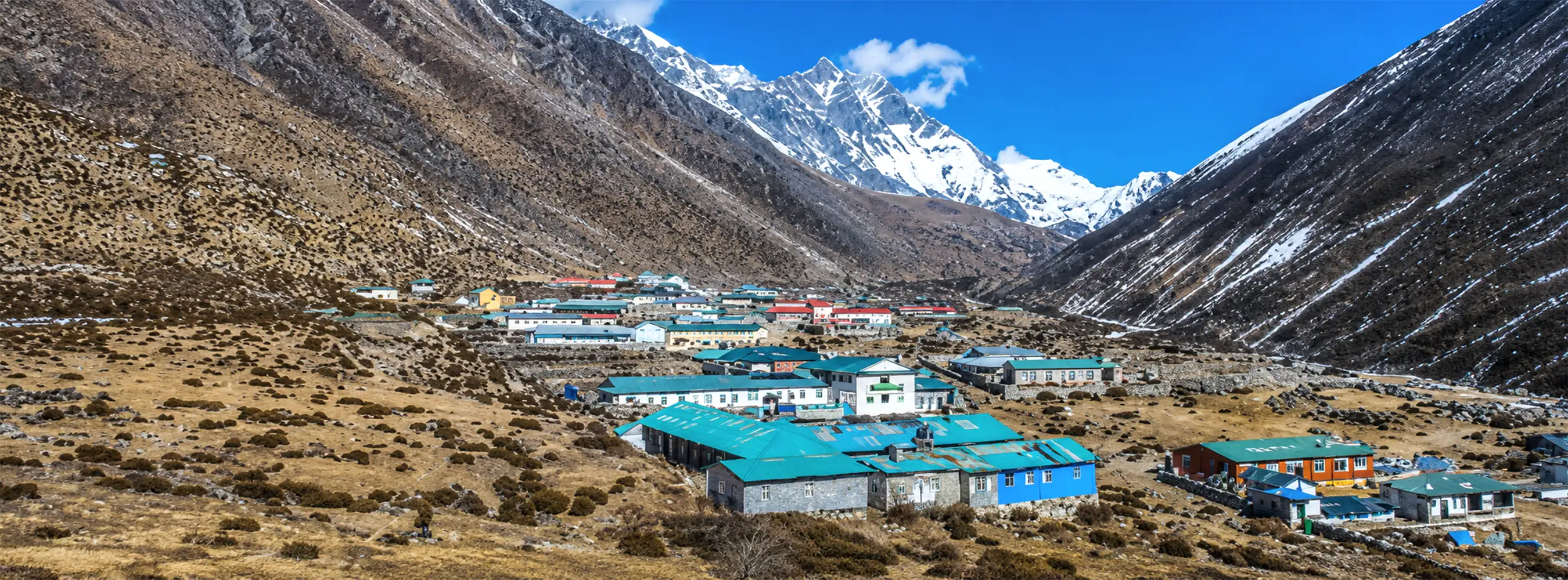
Dingboche
- Places
- Edited By: Accessnepaltour .Updated on: 23 Jul 2026
Dingboche, Nepal: The Complete Guide to Everest’s Acclimatization Stop
There’s a particular kind of silence in Dingboche. Not the peaceful, postcard kind, but the thin, wind-scoured quiet of a place sitting well above the treeline, where stone walls hunch low against the wind and every breath feels slightly incomplete. For most Everest Base Camp trekkers, this is the village where the trip stops feeling like a long walk and starts feeling like a genuine test of patience.
Dingboche isn’t a place people plan to visit for its own sake, at least not at first. It’s a mandatory stop, a name on an itinerary between Tengboche and Lobuche. But spend two nights here, as almost every trekker does, and it becomes something more: a working Sherpa village with its own customs, its own strange and specific traditions, and views of Ama Dablam that rival anything else on the entire route. This guide covers everything, the practical and the surprising.
Dingboche Facts
- Location: Imja Valley, Khumbu region, Solukhumbu District, Koshi Province, Nepal, inside Sagarmatha National Park.
- Coordinates: 27°53′N, 86°49′E.
- Altitude: 4,410 meters (14,470 ft).
- Distance from Kathmandu: Roughly 130 km by air to Lukla, then an additional 5–6 days of trekking (approximately 45–50 km on foot) to reach Dingboche.
- Significance: The primary high-altitude acclimatization stop on the Everest Base Camp trek; most trekkers spend two nights here before continuing higher.
- Population: Around 200 permanent residents, mostly Sherpa, with numbers fluctuating seasonally with tourism.
- Known for: Acclimatization hikes, panoramic views of Ama Dablam and Lhotse, and an unusual local tradition of leaving the village entirely for a month each summer.
Where Is Dingboche Located?
Dingboche sits in the Imja Valley, part of the Khumbu region in Nepal’s Solukhumbu District, within Koshi Province. The entire area falls inside Sagarmatha National Park, a UNESCO World Heritage Site named after the Nepali name for Mount Everest. The village’s precise coordinates are 27°53′N, 86°49′E, tucked into a broad valley flanked by Nangkartshang Peak (5,083m) to the north and the dramatic wall of Ama Dablam (6,812m) to the south.
Geographically, Dingboche sits just off the main Everest Base Camp trail, in what’s often called a side valley, positioned northeast of Tengboche and Pangboche. The turquoise Imja River runs along its eastern edge, and the village is roughly 1.5 km west of that river and about 8.4 km northeast of Lobuche, the next major stop for trekkers heading toward Base Camp.
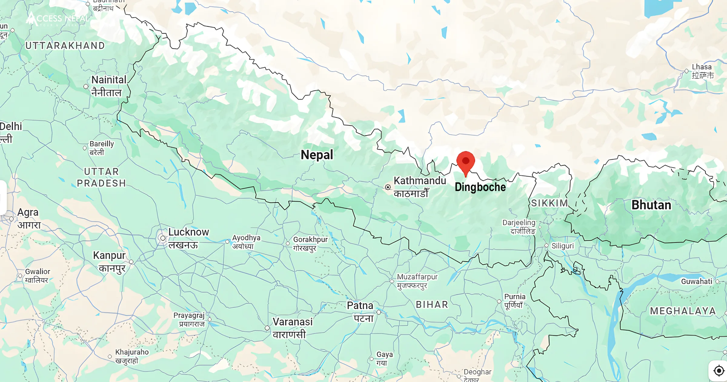
Locating Dingboche on the map of Nepal
How Far Is Dingboche From Kathmandu?
There’s no road to Dingboche, so getting there is a two-stage journey. The first option is flying to Lukla. The trip starts with a short domestic flight from Kathmandu (or, during peak seasons, from Ramechhap’s Manthali Airport) to Lukla, roughly 130–150 km northeast of Kathmandu as the crow flies. The flight itself takes around 30–35 minutes.
Second Option: trekking to Dingboche
From Lukla, there’s no shortcut; everyone walks. The standard route runs from Lukla to Phakding, Namche Bazaar, Tengboche, and finally Dingboche, typically covering:
| Leg | Distance | Typical Time |
| Lukla to Phakding | ~6–9 km | 3–4 hours |
| Phakding to Namche Bazaar | ~12–13 km | 5- 6 hours |
| Namche Bazaar | acclimatization day | Short hikes only rest day |
| Namche to Tengboche | ~10 km | 5- 6 hours |
| Tengboche to Dingboche | ~9-12 km | 5- 6 hours |
Total one-way trekking distance from Lukla to Dingboche: approximately 45–50 km, typically covered over 5–6 walking days, including the standard acclimatization day at Namche Bazaar.
Dingboche Altitude
Dingboche sits at 4,410 meters (14,470 feet) above sea level, making it one of the highest permanent settlements along the entire Everest Base Camp route. At this elevation, oxygen availability drops to roughly 60% of what’s available at sea level, a genuinely significant reduction that most visitors feel immediately in the form of breathlessness on even mild inclines.
Dingboche sits higher than Everest Base Camp for the Kilimanjaro comparison crowd (5,895m Kilimanjaro summit aside), and considerably higher than the elevation at which most people have ever spent the night. It’s roughly the same altitude as Everest Base Camp on some Himalayan treks elsewhere in the world, yet here it’s simply a rest stop along the way to something higher still.
Why Dingboche Matters: Its Role and Significance
Dingboche isn’t just a village that happens to sit at a convenient elevation; it’s functionally the hinge point of the entire Everest Base Camp trek.
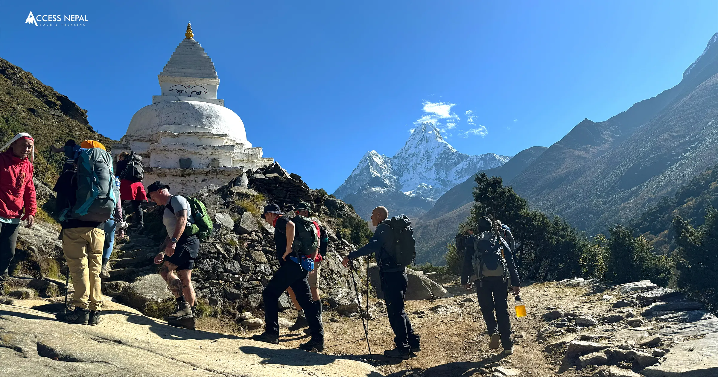
On the way to Everest Base Camp Trek
Nearly every trekking itinerary, independent or guided, builds in at least one full rest day at Dingboche. This isn’t a suggestion; it’s close to a physiological requirement. Above roughly 3,000 meters, the body needs deliberate time to adjust to thinner air, and Dingboche is positioned at exactly the elevation where that adjustment becomes non-negotiable before pushing on toward Lobuche, Gorak Shep, and Everest Base Camp itself.
A junction, not just a stop
Dingboche also functions as a route junction. From here, trekkers can continue toward Everest Base Camp via Lobuche, or branch toward Chhukung and onward to Island Peak. This dual role, gateway to both EBC and one of Nepal’s most popular trekking peaks, gives Dingboche a strategic importance beyond simple acclimatization.
The “summer valley”
Locally, Dingboche is sometimes referred to as the “summer valley” of the Khumbu, a nod to the brief growing season during which villagers cultivate barley and potatoes in stone-walled fields, some of the highest-altitude agriculture practiced anywhere in the world. Those low stone walls crisscrossing the landscape aren’t decorative, they exist specifically to shield fragile crops from the relentless high-altitude wind.
Altitude Sickness in Dingboche
This is the part of the Dingboche story that matters most, and the reason nearly every guide insists on the extra rest day here. At 4,410 meters, with oxygen levels around 40–60% lower than sea level (depending on how the comparison is measured), the risk of Acute Mountain Sickness (AMS) rises sharply. Pushing through Dingboche too quickly, without proper adjustment, increases the risk of far more serious conditions: High Altitude Pulmonary Edema (HAPE) and High Altitude Cerebral Edema (HACE), both potentially life-threatening buildups of fluid in the lungs or brain.
Recognizing Mild AMS
- Early warning signs are common and, if addressed promptly, usually manageable:
- Headache
- Dizziness or lightheadedness
- Nausea
- Fatigue disproportionate to the day’s effort
The standard response is simple: rest, hydrate, and pause your ascent until symptoms genuinely improve, not just fade slightly.
Recognizing Severe AMS
More serious symptoms demand immediate action, not observation:
- Confusion or disorientation
- A cough producing pink or frothy sputum
- Loss of coordination or difficulty walking a straight line
- Severe, worsening headache unresponsive to rest
If any of these appear, immediate descent of 500–1,000 meters is the only reliable treatment, alongside seeking medical help as quickly as possible.
How to Prevent Altitude Sickness in Dingboche?
A handful of well-established habits meaningfully reduce your risk:
- Hydrate aggressively. Aim for 4–5 liters of water daily, the dry mountain air and physical exertion both accelerate fluid loss.
- Follow “climb high, sleep low.” Take a day hike to a higher elevation, such as Nangkartshang Peak, then return to sleep at Dingboche’s lower altitude. This is the single most effective non-medical acclimatization strategy.
- Avoid alcohol and sleeping pills. Both suppress breathing during sleep, which is exactly the wrong effect at altitude.
- Eat carbohydrate-rich meals. Dal bhat, noodles, and similar high-energy foods support your body’s adjustment far better than heavy, fatty meals.
- Consider preventive medication. Some trekkers use acetazolamide (Diamox) as a preventive measure, typically in modest twice-daily doses, but this should always be discussed with a doctor before your trip, not decided on the trail.
- Never ignore worsening symptoms. A headache that’s getting worse, not better, is the clearest signal that something needs to change, immediately.
Where to Get Help if Serious Situation Occurs?
The nearest proper medical facility is the Himalayan Rescue Association clinic in Pheriche, roughly two hours away on foot. Emergency helicopter evacuation is also available throughout the region for serious cases, though this depends on weather and should be backed by travel insurance that explicitly covers high-altitude rescue.
Culture and Tradition of Dingboche
Every year, during the Nepali month of Shrawan (roughly mid-July to mid-August), many residents of Dingboche traditionally leave the village entirely for about a month, relocating temporarily to nearby settlements.
According to local custom, this tradition, sometimes referred to informally as “Ding”, stems from a belief that food shouldn’t be cooked within the village during this specific period, tied to the wellbeing of the livestock the community depends on. Historically, this was observed strictly; today, it’s followed more loosely. Some business owners and families still relocate for the month, while others have chosen to stay and cook as usual. It’s a small, fading custom, but one that speaks to how deeply local life here remains tied to the rhythms of animal husbandry and seasonal belief, even as the village increasingly caters to international trekkers.
Stone Cairns and Chortens: The Spiritual Landscape
Walking through Dingboche, you’ll notice more than mountains. Scattered along the trails and clustered near the village are stone cairns, sometimes called chortens or memorial cairns, often draped in weathered prayer flags. These aren’t random rock piles. In Sherpa and Tibetan Buddhist tradition, each placed stone represents a small offering or prayer, and the structures collectively serve several purposes: blessing travelers with safe passage, honoring climbers and Sherpas who lost their lives in the mountains, and functioning as literal trail markers in terrain where paths aren’t always obvious.
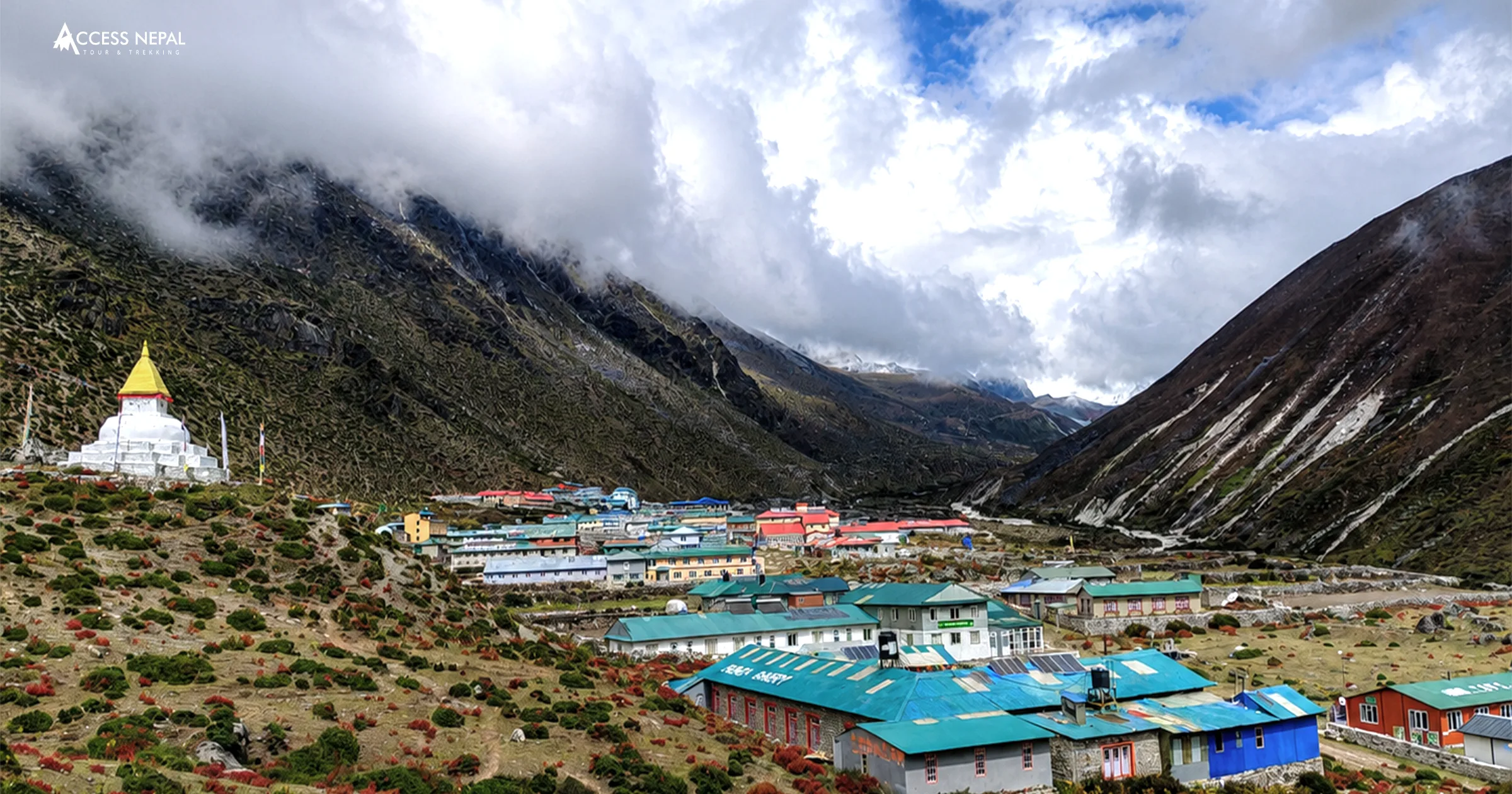
Dingboche, Nepal
The prayer flags themselves follow a specific five-color sequence, blue, white, red, green, and yellow, representing sky, air, fire, water, and earth respectively. As wind moves through them, the tradition holds that they carry blessings outward across the valley. A proper Buddhist chorten (stupa) also stands near the village, wrapped in white ceremonial scarves and serving as a genuine spiritual landmark for both residents and passing trekkers.
Things to Do in Dingboche
Rest days here aren’t meant to be spent lying in a teahouse bed, gentle movement actually aids acclimatization better than complete inactivity.
Nangkartshang peak hike
The single best acclimatization hike from Dingboche, a moderately challenging 4–5 hour round trip climbing to roughly 5,083 meters. The reward at the top is a genuinely spectacular 360-degree panorama, Everest, Lhotse, Makalu, Nuptse, Cho Oyu, and Ama Dablam are all visible from a single vantage point.
Imja river walk
A gentler, 1–2 hour option for those wanting an easier acclimatization walk. The route follows the turquoise glacial waters of the Imja River past mani stones and prayer flags, with quieter, more contemplative scenery than the peak hike.
Day Trips to Nearby Villages
- Pheriche (roughly 1 hour): home to the Himalayan Rescue Association clinic
- Chhukung (roughly 2 hours): the gateway village for Island Peak climbers
- Pangboche (roughly 3 hours): site of the Khumbu region’s oldest monastery
- Sunrise at Ama Dablam Viewpoint
Head to the eastern edge of the village at dawn. As the light hits Ama Dablam’s near-vertical ridgeline, the mountain takes on a pink-gold glow that many trekkers, and more than a few professional photographers, consider the single most photogenic moment of the entire everest region.
Accommodation in Dingboche
Facilities here are simple but functional, exactly what you’d expect from a village whose entire economy exists to support acclimatizing trekkers. Twin-share teahouse rooms are standard, typically priced in the $3–20 per night range, often effectively discounted if you’re eating your meals at the same lodge. Communal dining halls, heated by yak-dung stoves, double as the social center of the village each evening. Expect solar-powered electricity, limited or paid Wi-Fi, and hot showers as an extra rather than a given. During peak seasons, March to May and September to November, arriving early in the day gives you the best chance at a good room before the village fills up.
Weather in Dingboche by Season
| Season | Daytime Temperature | Nighttime Temperature |
| Spring (Mar–May) | 0°C to 6°C | -24°C to -13°C |
| Summer (Jun–Aug) | 9°C to 12°C | -5°C to -1°C |
| Autumn (Sep–Nov) | 1°C to 10°C | -23°C to -6°C |
| Winter (Dec–Feb) | -5°C to -1°C | -30°C to -27°C |
Spring and autumn remain the most favorable trekking windows, offering the best balance of manageable daytime temperatures and clear mountain visibility. Winter’s extreme cold and summer’s monsoon cloud cover both make Dingboche noticeably harder going, in different ways.
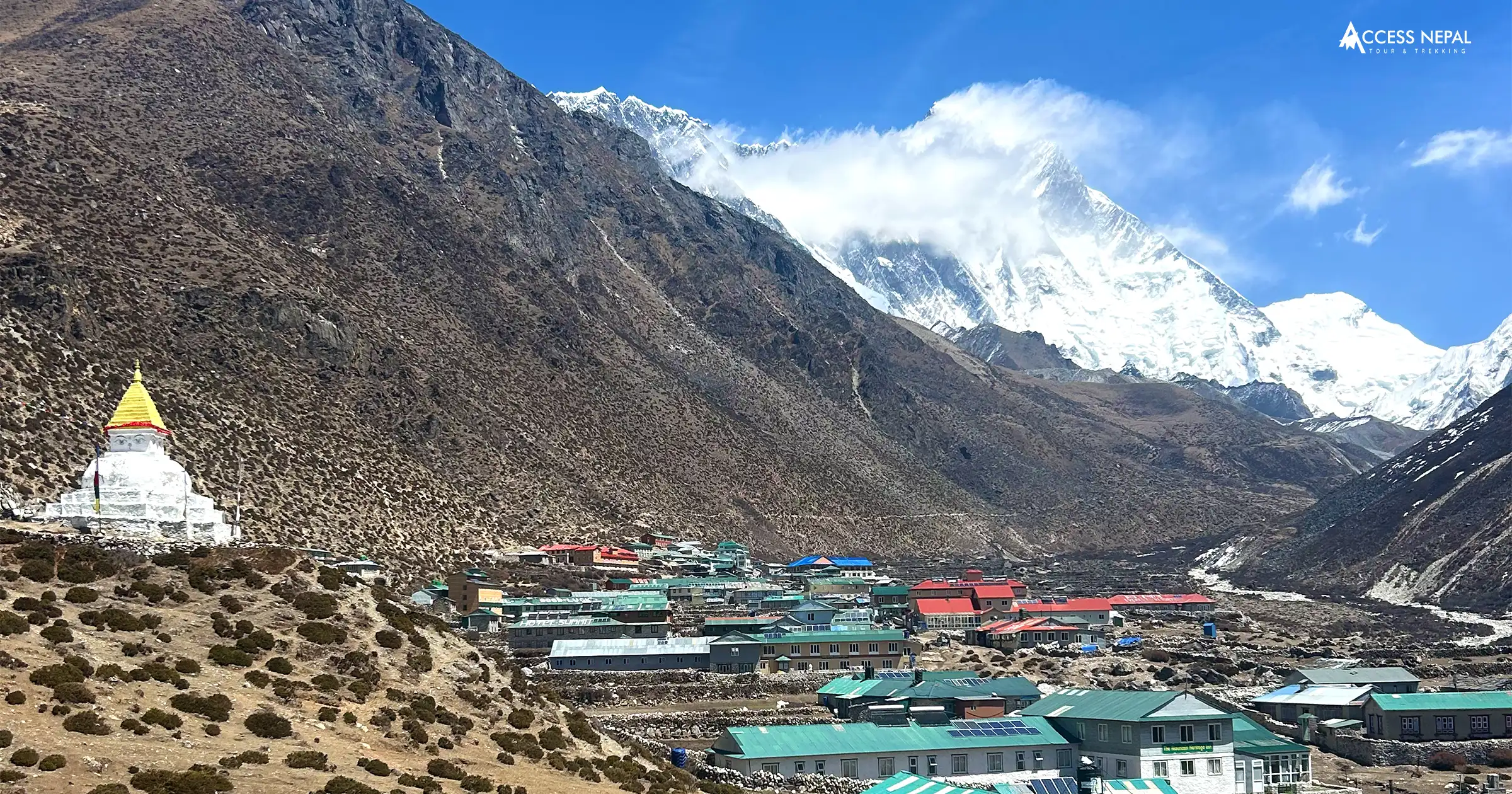
Dingboche
Dingboche Frequently Asked Questions
Where is Dingboche located?
Dingboche sits in the Imja Valley of Nepal’s Khumbu region, within Sagarmatha National Park, along the Everest Base Camp trekking route between Tengboche and Lobuche.
What is the altitude of Dingboche?
The altitude of Dingboche is 4,410 meters (14,470 feet) above sea level, one of the highest permanent settlements on the Everest Base Camp trek.
How far is Dingboche from Kathmandu?
Roughly 130 km by air to Lukla, followed by an additional 5–6 days of trekking, approximately 45–50 km on foot, to reach Dingboche.
Is an acclimatization stop at Dingboche mandatory?
It’s not legally required, but it’s treated as essential by virtually every trekking agency and guide. Most itineraries build in at least one full rest day here specifically to reduce the risk of altitude sickness.
What is the oxygen level at Dingboche?
Oxygen availability at 4,410 meters is roughly 40–60% lower than at sea level, a significant enough drop that acclimatization is genuinely necessary before continuing higher.
What is the “Ding” tradition in Dingboche?
A local custom in which many residents traditionally leave the village for about a month during the Nepali month of Shrawan (mid-July to mid-August), tied to a belief around not cooking in the village during this period for the wellbeing of livestock. It’s observed less strictly today than in the past.
Conclusion
Dingboche rarely gets mentioned as a destination in its own right; it’s the rest stop, the acclimatization day, the place you pass through on the way to something bigger. But look closer and it’s a village with genuine texture: stone-walled potato fields at the edge of viable altitude, a monastery quietly anchoring daily life, cairns and prayer flags carrying centuries of belief across a windswept valley, and a summer tradition still observed, however loosely, by families who’ve called this place home for generations. Take your rest day seriously here, both for your lungs and for the chance to actually see the place.

Why Nepal is Budget Travel Destinations in Asia?
Prev
Mera Peak vs Island Peak: Which Trekking Peak Should You Climb First?
NextAwards and Achievements
Access Nepal Tour and Treks has been recognized with TripAdvisor’s prestigious Travelers’ Choice Award for multiple consecutive years, reflecting our unwavering commitment to quality and clients’ satisfaction.













Leave Your Comment