

Annapurna Circuit Trek Elevation: Complete Altitude Guide
- Places
- By accessnepaltour
Understanding every metre of the world’s greatest trek — before you take your first step.
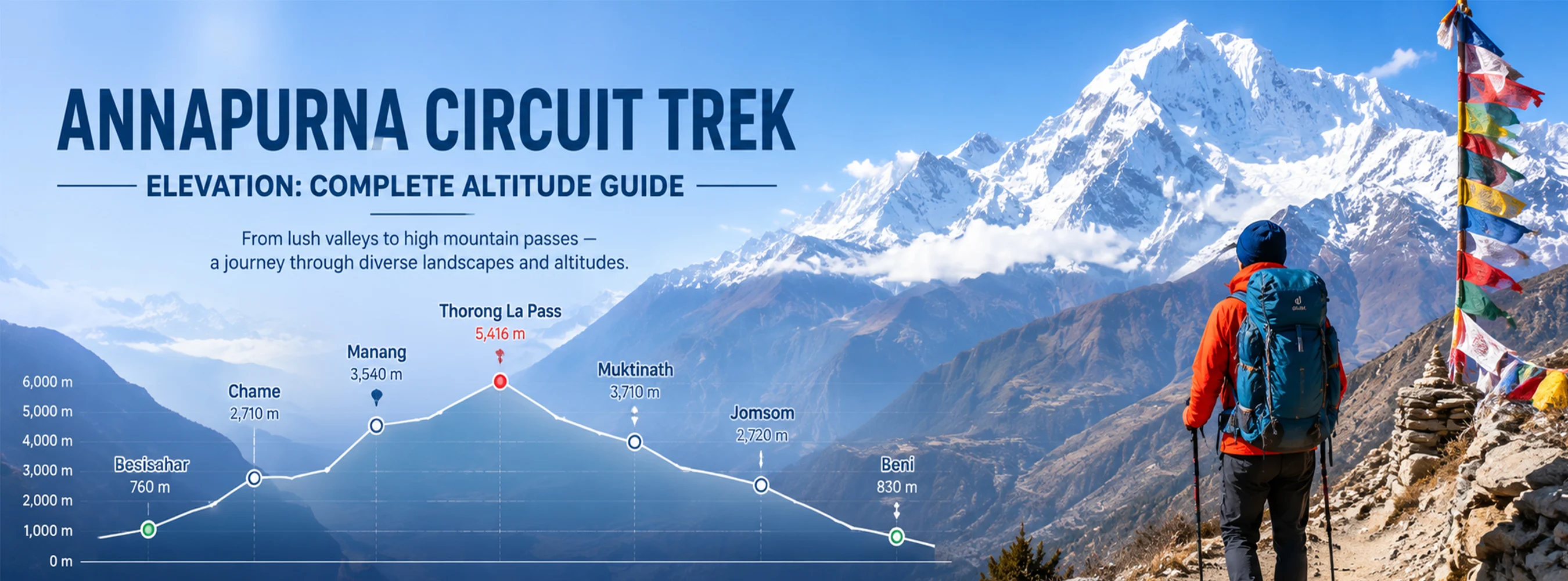
The Annapurna Circuit Trek is widely regarded as one of the finest long-distance trekking routes on Earth — not because it reaches the highest altitude, but because of what it does with elevation. No other trek in Nepal takes you from subtropical river valleys at 800 metres through temperate forests, alpine meadows, high desert plateaus, and over a 5,416-metre Himalayan pass before descending back to subtropical lakeside warmth — all within a single continuous journey of 160 to 230 kilometres depending on the route variant chosen.
Elevation is not merely a statistic on the Annapurna Circuit. It is the story. Every climate zone, every cultural shift, every change in vegetation, architecture, ethnicity, and language that you encounter on the trail is a direct consequence of altitude.
Understanding the elevation profile of the Annapurna Circuit before you go is not just useful preparation — it is the key to understanding why this trek is so extraordinarily diverse, why it demands respect, and why trekkers who complete it consistently describe it as a transformative experience.
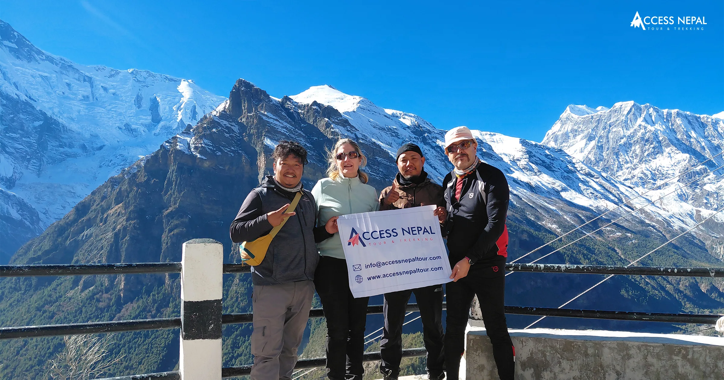
Trekkers from diverse countries completed the Annapurna Circuit Trek
Annapurna Circuit Trek Elevation Guide: Gain and Elevation Loss
The total elevation statistics of the Annapurna Circuit place it in a category of its own among Himalayan trekking routes.
Total elevation gain: approximately 7,200 metres across the full circuit
Total elevation loss: approximately 7,600 metres across the full circuit
Maximum elevation: Thorong La Pass at 5,416 metres (17,769 ft)
Minimum starting elevation: Besisahar at 760 metres (2,493 ft) or Jagat at 1,300 metres (4,265 ft)
Minimum ending elevation: Pokhara at 822 metres (2,696 ft)
These figures reveal something important that many trekkers overlook when planning: the Annapurna Circuit is not a steady uphill climb followed by a descent. It is a constantly undulating route that crosses dozens of ridges, drops into deep river gorges, and climbs back out again every single day — meaning your legs accumulate far more total climbing than the net elevation profile suggests. The Thorong La pass crossing itself involves a single-day gain of nearly 1,000 metres from Thorong Phedi (4,525m) to the pass summit (5,416m), followed by a knee-testing descent of 1,600 metres to Muktinath (3,800m).
Day-by-Day Annapurna Circuit Trek Elevation Guide
The following day-by-day profile follows the classic full circuit route starting from Besisahar and ending in Pokhara via Jomsom and Tatopani, covering approximately 21 days at a comfortable, safe acclimatization pace.
| Day | Route | Start (M) | End (m) | Net Change | Daily Walking |
| 1. | Drive Pokhara/Kathmandu → Besisahar → Bhulbhule | 760 | 840 | +80m | 3–4 hrs |
| 2. | Bhulbhule → Ngadi → Jagat | 840 | 1,300 | +460m | 5–6 hrs |
| 3. | Jagat → Dharapani → Chame | 1,300 | 2,670 | +1,370m | 6–7 hrs |
| 4. | Chame → Pisang (Lower/Upper) | 2,670 | 3,300 | +630m | 5–6 hrs |
| 5. | Pisang → Manang (via Ghyaru/Ngawal) | 3,300 | 3,519 | +219m | 5–7 hrs |
| 6. | Acclimatization day — Manang | 3,519 | 3,519 | 0m | Rest/short hike |
| 7. | Manang → Ice Lake day hike (optional) | 3,519 | 4,600 | +1,081m | 6–7 hrs return |
| 8. | Manang → Yak Kharka | 3,519 | 4,018 | +499m | 3–4 hrs |
| 9. | Yak Kharka → Thorong Phedi / High Camp | 4,018 | 4,525–4,925 | +507–907m | 3–4 hrs |
| 10 | Thorong Phedi → Thorong La → Muktinath | 4,525 | 3,800 | +891m / −1,616m | 7–8 hrs |
| 11 | Muktinath → Kagbeni → Jomsom | 3,800 | 2,720 | −1,080m | 5–6 hrs |
| 12 | Jomsom → Marpha → Tukuche | 2,720 | 2,590 | −130m | 4–5 hrs |
| 13 | Tukuche → Kalopani → Lete | 2,590 | 2,480 | −110m | 5–6 hrs |
| 14 | Lete → Ghasa → Tatopani | 2,480 | 1,190 | −1,290m | 5–6 hrs |
| 15 | Tatopani → Ghorepani | 1,190 | 2,860 | +1,670m | 6–7 hrs |
| 16 | Ghorepani → Poon Hill → Tadapani | 2,860 | 2,630 | −230m (+350m Poon Hill) | 6–7 hrs |
| 17 | Tadapani → Chhomrong → Sinuwa | 2,630 | 2,360 | −270m | 5–6 hrs |
| 18 | Sinuwa → Bamboo → Jhinu Danda | 2,360 | 1,780 | −580m | 4–5 hrs |
| 19 | Jhinu Danda → Nayapul → Pokhara | 1,780 | 822 | −958m | 3–4 hrs + drive |
Sample Day Breakdown — The Climb High, Sleep Low Principle in Action
To illustrate how the Annapurna Circuit elevation profile works in practice, here is a detailed breakdown of one of the most important sample days on the trek — the final approach and high pass crossing:
Sample Distance: 16.2 km / 10.07 mi
Duration: 5–6 hrs trekking (plus 2–3 hrs descent to Muktinath if doing full Thorong La day)
Starting Altitude: Thorong Phedi — 4,525m / 14,846 ft
Maximum Altitude: Thorong La Pass — 5,416m / 17,769 ft
End Altitude (Muktinath side descent to Pokhara eventually): Pokhara — 822m / 2,696 ft
This single day encapsulates everything that makes the Annapurna Circuit elevation profile unique. You begin at nearly 4,525 metres in the pre-dawn darkness — usually a 4 to 5 am start is required — and climb 891 metres through progressively thinning air to the highest point of the entire circuit. At the pass, prayer flags snap in the wind, and a cairn marks the literal dividing line between the lush green Marsyangdi valley system to the east and the rain-shadow desert of Mustang to the west. The world is physically different on either side of this stone ridge — and elevation is the reason.
The descent from the pass to Muktinath drops 1,616 metres in 8.7 kilometres — steep, knee-intensive, and requiring careful footwork on loose scree in the upper section. By the time you reach Muktinath’s sacred temples, you have moved through four distinct climate zones in a single walking day. This day alone justifies the Annapurna Circuit’s reputation as one of the world’s great elevation journeys.
Annapurna Circuit Trek Distance vs Elevation
The relationship between distance and elevation on the Annapurna Circuit is non-linear in ways that consistently surprise trekkers who plan based on distance alone.
The key insight is this: a 10 km day on the Annapurna Circuit can feel easier or harder than a 20 km day depending entirely on the elevation profile of each specific stage. The Day 15 climb from Tatopani (1,190m) to Ghorepani (2,860m) covers only about 12 kilometres but gains 1,670 metres of elevation — one of the steepest sustained climbs on the entire route. Conversely, the descent day from Jomsom to Marpha covers a similar distance but loses only 130 metres and feels almost effortless by comparison.
Elevation per kilometre benchmarks on the Annapurna Circuit:
| Section | Distance | Elevation Change | Metres/Km | Difficulty |
| Besisahar → Jagat | 22 km | +540m | 24.5m/km | Easy |
| Jagat → Chame | 30 km | +1,370m | 45.7m/km | Moderate |
| Chame → Manang | 26 km | +849m | 32.7m/km | Moderate |
| Thorong Phedi → Pass | 7.5 km | +891m | 118.8m/km | Very Hard |
| Pass → Muktinath | 8.7 km | −1,616m | 185.7m/km | Hard |
| Tatopani → Ghorepani | 12 km | +1,670m | 139.2m/km | Very Hard |
Altitude Sickness and Acclimatization on the Annapurna Circuit Trek
No guide to the Annapurna Circuit elevation is complete without an honest, detailed treatment of altitude sickness because the elevation profile of this trek passes through and above the altitude ranges where Acute Mountain Sickness (AMS), High Altitude Pulmonary Edema (HAPE), and High Altitude Cerebral Edema (HACE) become genuine medical risks.
The Three Altitude Zones on the Annapurna Circuit
Zone 1 — Below 3,000 metres (Besisahar to Chame)
At these elevations, altitude sickness is unlikely for the vast majority of trekkers. Mild symptoms such as slight breathlessness on steep ascents are normal and do not indicate AMS. Focus here should be on building walking fitness for the higher sections ahead.
Zone 2 — 3,000 to 4,500 metres (Chame to Thorong Phedi)
This is where acclimatization becomes essential and where AMS most commonly strikes on the Annapurna Circuit. Manang at 3,519 metres is the designated mandatory acclimatization stop, and the rest day here is non-negotiable for safe continuation. Symptoms to watch for include persistent headache, loss of appetite, nausea, dizziness, disturbed sleep, and unusual fatigue.
Zone 3 — Above 4,500 metres (Thorong Phedi to Pass Summit)
Above 4,500 metres, you are in high-altitude territory where the risk of HAPE and HACE increases significantly with any rapid ascent. The 5,416-metre pass summit is above the level where extended time without acclimatization becomes genuinely dangerous. The standard safety protocol — arrive at Thorong Phedi in the afternoon, sleep there, begin the pass crossing before dawn — is designed to minimize time at extreme altitude.
Related Packages
Annapurna Base Camp Trek - 11 Days
 4,130m/13,550ft
 Moderate
 All
Inclusive Plan
All
Inclusive Plan
The Golden Rules of Acclimatization
The international high-altitude medicine community has established clear principles for safe altitude gain that are directly applicable to the Annapurna Circuit:
Never gain more than 300 to 500 metres of sleeping altitude per day above 3,000 metres. The Annapurna Circuit itinerary is specifically designed to respect this limit — which is why the rest day at Manang and the short stage from Manang to Yak Kharka exist.
Climb high, sleep low. Day hikes to higher elevations followed by returning to lower sleeping altitudes stimulate red blood cell production without the risk of sleeping at elevations your body has not yet adjusted to. The optional Ice Lake hike from Manang — gaining over 1,000 metres and then returning to sleep at 3,519 metres — is specifically designed to apply this principle.
Descend at the first sign of serious symptoms. No mountain view, no summit, no peer pressure is worth ignoring deteriorating AMS symptoms. The treatment for altitude sickness is descent — always.
AMS Symptom Quick Reference:
| Symptom | Mild AMS | Serious – Descend Immediately |
| Headache | Dull, manageable with rest | Severe, unresponsive to medication |
| Nausea | Mild, no vomiting | Vomiting, unable to keep fluids down |
| Breathing | Slightly laboured at exertion | Breathless at rest, gurgling sounds |
| Mental state | Slight fatigue, mild confusion | Disorientation, loss of coordination, altered consciousness |
| Sleep | Disrupted, vivid dreams | Cannot sleep, suffocating sensation |
Annapurna Circuit Trek Elevation Guide in Feet and Meters
For international trekkers accustomed to different measurement systems, here is the complete elevation reference for all key points on the Annapurna Circuit:
| Location | Elevation (m) | Elevation(ft) | Significance |
| Besisahar | 760m | 2,493 ft | Trek starting point |
| Jagat | 1,300m | 4,265 ft | Marsyangdi Gorge entry |
| Dharapani | 1,860m | 6,102 ft | Restricted area checkpoint |
| Chame | 2,670m | 8,760 ft | Manang district HQ |
| Lower Pisang | 3,200m | 10,499 ft | Annapurna views begin |
| Upper Pisang | 3,310m | 10,860 ft | Classic viewpoint |
| Manang | 3,519m | 11,545 ft | Mandatory acclimatization stop |
| Ice Lake (optional) | 4,600m | 15,092 ft | Acclimatization day hike |
| Yak Kharka | 4,018m | 13,182 ft | High pastoral grazing |
| Thorong Phedi | 4,525m | 14,846 ft | Pass base camp |
| High Camp | 4,925m | 16,158 ft | Optional overnight |
| Thorong La Pass | 5,416m | 17,769 ft | Highest point of trek |
| Muktinath | 3,800m | 12,467 ft | Sacred pilgrimage site |
| Kagbeni | 2,810m | 9,219 ft | Gateway to Upper Mustang |
| Jomsom | 2,720m | 8,924 ft | Airport, Mustang HQ |
| Marpha | 2,670m | 8,760 ft | Apple orchards, brandy |
| Tukuche | 2,590m | 8,497 ft | Historic trading village |
| Tatopani | 1,190m | 3,904 ft | Famous hot springs |
| Ghorepani | 2,860m | 9,383 ft | Rhododendron forest hub |
| Poon Hill | 3,210m | 10,531 ft | Iconic sunrise viewpoint |
| Nayapul | 1,070m | 3,510 ft | Trek end point |
| Pokhara | 822m | 2,696 ft | Final destination |
Annapurna Circuit Trek Elevation vs Everest Base Camp Trek Elevation — A Direct Comparison
This is one of the most frequently asked questions among trekkers choosing between Nepal’s two greatest routes and the answer is more nuanced than most comparison articles acknowledge.
| Comparison Point | Annapurna Circuit | Everest Base Camp |
| Maximum elevation | 5,416m (Thorong La) | 5,550m (Kala Patthar) |
| Average daily elevation | 3,200m | 3,800m |
| Days above 4,000m | 4–5 days | 8–10 days |
| Days above 5,000m | 1 day (crossing day) | 2–3 days |
| Total elevation gain | ~7,200m | ~4,800m |
| Total elevation loss | ~7,600m | ~4,800m |
| Starting elevation | 760 m (Besisahar) | 2,860m (Lukla) |
| Ending elevation | 822m (Pokhara) | 2,860m (Lukla) |
| Elevation diversity | Extreme — 760m to 5,416m | Moderate — 2,860m to 5,550m |
| Altitude Sickness Risk | High on crossing day | High from Day 8 onward |
| Duration | 14–21 days | 12–14 days |
The key insight: The Everest Base Camp Trek spends more cumulative time at very high altitude — above 4,500 metres — making it statistically more demanding in terms of sustained altitude exposure. The Annapurna Circuit reaches a higher point of acute maximum elevation stress on crossing day but descends dramatically afterward, giving the body rapid relief.
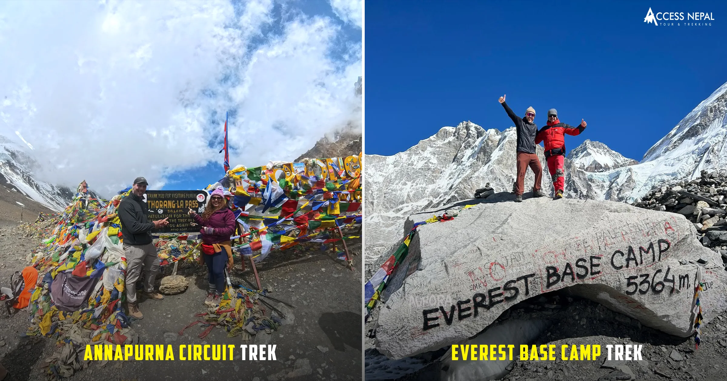
Everest Base Camp Vs Annapurna Circuit Trek
The Annapurna Circuit’s total elevation gain is significantly higher than the EBC trek because of its constantly undulating terrain — even though its maximum altitude is modestly lower. In terms of total physical demand on the legs over the full duration, the Annapurna Circuit is the harder route. In terms of altitude acclimatization challenge, the two routes are roughly comparable.
Difficulty Level on the Annapurna Circuit Trek Elevation Guide
Elevation is the single most important factor in assessing the difficulty of the Annapurna Circuit, and it operates at three levels simultaneously:
Physical Difficulty from Elevation Gain
The cumulative 7,200 metres of ascent across 14 to 21 days represents a significant physical undertaking for any trekker. The daily elevation gains listed in the day-by-day profile show that several stages exceed 1,000 metres of ascent — equivalent to climbing a very tall urban skyscraper’s worth of stairs while carrying a loaded backpack and breathing thinner air.
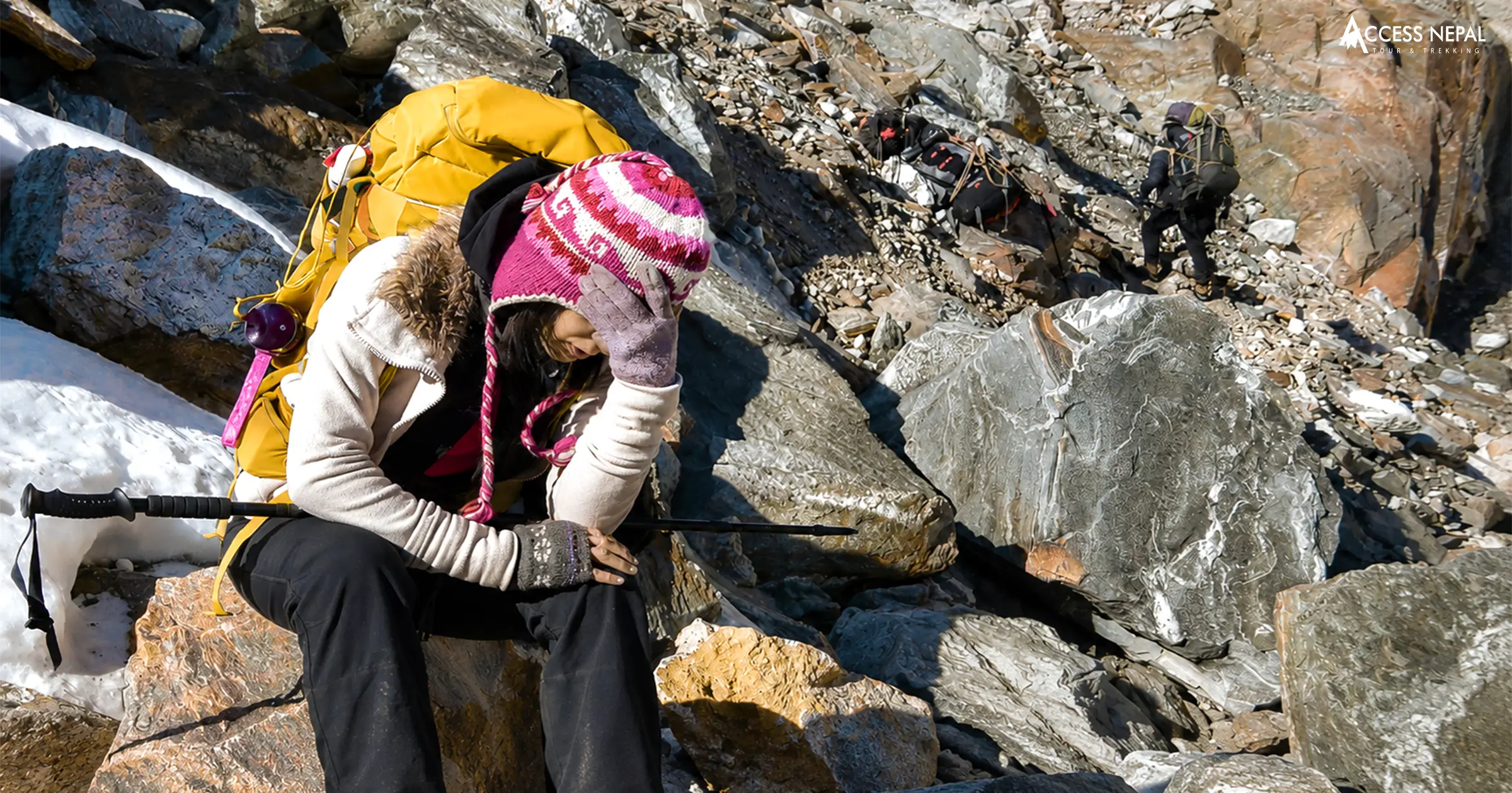
Physiological Difficulty from Altitude
Above 3,000 metres, the body’s physiological response to reduced oxygen creates a difficulty that has no parallel in low-altitude trekking. Trekkers consistently report that their cardiovascular fitness — however well trained at sea level — provides only partial preparation for the breathlessness, fatigue, and slowed recovery of high altitude. A rest day at Manang is not optional. It is the single most important safety and comfort decision on the entire trek.
Psychological Difficulty from Elevation
The Thorong La crossing requires a psychological resilience that the lower sections of the circuit do not demand. Starting in the dark at 4 to 5 am, climbing into thinning air with cold wind and potential snow, covering 7.5 kilometres to the pass summit — all before descending a further 8.7 kilometres to Muktinath — is a full day of continuous effort at the extreme upper range of trekking altitude. Mental preparation for this day is as important as physical preparation.
Physiological difficulty from altitude
Overall difficulty rating: Moderate to Challenging — accessible to fit, prepared trekkers of all experience levels with proper acclimatization, but not to be underestimated.
Tips for Trekking at High Elevation on the Annapurna Circuit
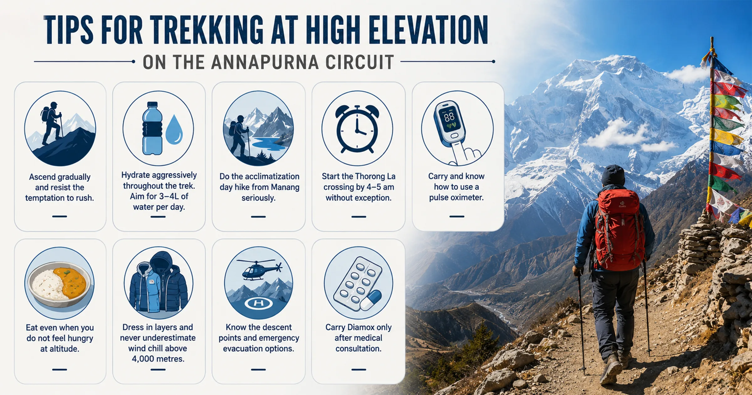
Ascend gradually and resist the temptation to rush. The most common mistake on the Annapurna Circuit is gaining altitude too quickly in the lower sections when the trekker feels strong, arriving in the high sections fatigued and under-acclimatized. Stick to the itinerary schedule.
Hydrate aggressively throughout the trek. Aim for at least 3 to 4 litres of water per day from Manang onward. Dehydration accelerates altitude sickness symptoms and makes the physiological challenge of high altitude significantly harder. Avoid alcohol above 3,000 metres as it inhibits acclimatization.
Related Packages
Annapurna Circuit Trek - 16 Days
- 5,416m/17,769ft
-
Challenging
- All
Inclusive Plan
Do the acclimatization day hike from Manang seriously. The Ice Lake hike to 4,600 metres is not a leisure option — it is a physiological preparation tool. Even a shorter hike to Gangapurna Lake (3,700m) followed by a return to sleep at Manang’s 3,519 metres meaningfully accelerates your body’s production of red blood cells.
Start the Thorong La crossing by 4 to 5 am without exception. Afternoon weather on the pass deteriorates rapidly and can be genuinely dangerous. Snow, strong winds, and whiteout conditions become possible from midday onward. Every experienced guide on the circuit follows the early start protocol for good reason.
Carry and know how to use a pulse oximeter. Blood oxygen saturation (SpO2) provides an objective measure of how your body is adapting to altitude. A reading above 85% at altitude is generally acceptable; below 80% is a warning sign requiring immediate rest or descent. Available cheaply online and in Kathmandu, a pulse oximeter is one of the most valuable small pieces of equipment on this trek.
Eat even when you do not feel hungry at altitude. Loss of appetite is a normal altitude response but continuing to fuel your body is essential for both energy and immune function. Dal bhat is specifically recommended at altitude — the carbohydrate-rich rice provides sustained fuel, the lentil soup contributes to hydration, and the caloric density supports the energy demands of high-altitude exertion.
Dress in layers and never underestimate the wind chill above 4,000 metres. A sunny morning at Thorong Phedi can become a bitterly cold crossing experience with wind gusts at the pass that drive the effective temperature well below what any thermometer reading suggests. Windproof outer layer, insulated mid-layer, and warm gloves are essential on crossing day regardless of the apparent morning temperature.
Know the descent points and emergency evacuation options. Helicopter landing pads exist at Manang and Jomsom. In a genuine medical emergency, descent is always the priority and evacuation from these points is the established protocol. Ensure your travel insurance covers helicopter evacuation before leaving Pokhara.
Carry Diamox only after medical consultation. Acetazolamide (Diamox) can be an effective preventive measure against AMS but has side effects and contraindications. Consult your doctor before departure — not upon arrival in Kathmandu.
Tips for trekking in high altitude
FAQs About Annapurna Circuit Trek Elevation
What is the highest point on the Annapurna Circuit Trek?
The highest point is Thorong La Pass at 5,416 metres (17,769 ft), crossed between Thorong Phedi on the eastern side and Muktinath on the western side. It is the defining physical and geographical highlight of the entire circuit.
How does the elevation of the Annapurna Circuit compare to other Himalayan treks?
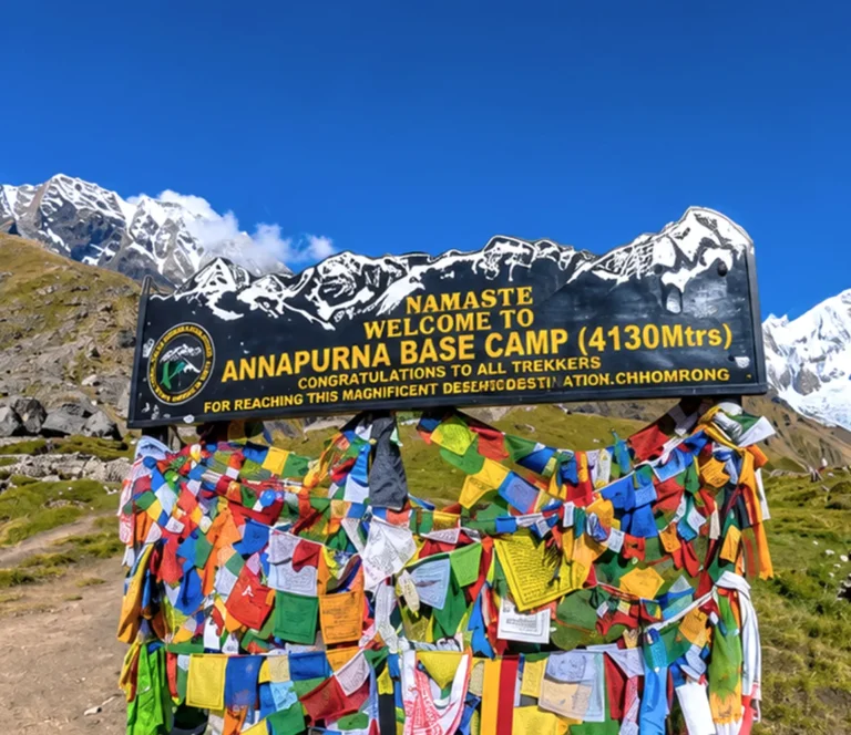
At 5,416 metres maximum, it sits above Annapurna Base Camp (4,130m) and is comparable to Everest Base Camp (5,364m), below Lobuche East Base Camp (4,950m) and significantly below any actual Himalayan summit. Among pure trekking routes without technical climbing, the Thorong La is one of the highest regularly crossed trekking passes in the world.
How many days should I spend acclimatizing on the Annapurna Circuit?
A minimum of one full rest day at Manang (3,519m) is non-negotiable. Two rest days at Manang are recommended for trekkers who have not previously trekked above 4,000 metres. Some experienced operators also recommend an intermediate night at Yak Kharka (4,018m) before proceeding to Thorong Phedi.
Can I do the Annapurna Circuit Trek in reverse — crossing Thorong La from west to east?
Technically possible but strongly discouraged. The ascent from Muktinath to the pass is significantly steeper and longer than the approach from Thorong Phedi, the descent to Manang is extremely steep, and trekking in this direction means gaining extreme altitude rapidly without the gradual acclimatization the standard direction provides. The conventional east-to-west direction exists for safety reasons.
Is Poon Hill (3,210m) part of the Annapurna Circuit elevation profile?
Poon Hill is a side trip from Ghorepani included in the standard Annapurna Circuit itinerary. At 3,210 metres it is not a challenging altitude point after what the circuit has already covered, but it is one of the most rewarding viewpoints on the entire route — offering a panoramic dawn view of Dhaulagiri, the entire Annapurna range, and Machhapuchhre that justifies every step of the 45-minute pre-dawn climb from Ghorepani.
What altitude is Pokhara at, and why does the circuit end there?
Pokhara sits at 822 metres (2,696 ft) above sea level — a dramatic contrast to the 5,416-metre pass crossed earlier in the same trek. The circuit ends in Pokhara because the trail naturally descends through the Annapurna Conservation Area’s southern slopes to the Pokhara valley, completing a genuine geographical circuit around the Annapurna massif. The descent to Pokhara’s altitude also ensures complete recovery from any residual altitude effects before international travel.
What happens if I develop altitude sickness on the circuit?
Stop ascending immediately. Rest at your current altitude for 24 hours. If symptoms do not improve or worsen, descend at least 300 to 500 metres immediately. Helicopter evacuation is available from Manang and Jomsom if required. Never continue ascending with worsening AMS symptoms under any circumstances.
Is altitude sickness more likely on the Annapurna Circuit or the Everest Base Camp Trek?
Both routes pass through and above AMS risk elevations. The Annapurna Circuit reaches a slightly higher maximum altitude (5,416m vs 5,364m at EBC), but the Everest route spends more consecutive days above 4,500 metres. Statistical rates of AMS are broadly comparable between the two routes when proper acclimatization protocols are followed on both.
Related Packages
Annapurna Circuit Trek with Tilicho Lake - 18 Days
- 5,416m/17,769ft
-
Challenging
- All
Inclusive Plan
Do I need supplemental oxygen on the Annapurna Circuit?
No. Supplemental oxygen is not used or necessary on the Annapurna Circuit at any point. Unlike the high camps of Everest or other 8,000-metre peaks where oxygen is essential for survival, the Thorong La at 5,416 metres is within the range that a healthy, properly acclimatized person can cross entirely on their own lung capacity.
What should my blood oxygen level (SpO2) be at altitude on the circuit?
At sea level, normal SpO2 is 95 to 99%. At Manang (3,519m), readings of 85 to 92% are common and generally acceptable. At Thorong Phedi (4,525m), readings of 78 to 88% are typical for acclimatized trekkers. Any reading below 75% warrants serious attention and medical assessment. Individual variation is significant — what matters most is the trend of your readings over time and the presence or absence of symptoms, not any single number in isolation.
The Annapurna Circuit does not ask you to be extraordinary. It asks you to be patient, prepared, and present — and in return it shows you a world that changes with every 100 metres of altitude gained. That is the deal. It is a very good one.
Awards and Achievements
Access Nepal Tour and Treks has been recognized with TripAdvisor’s prestigious Travelers’ Choice Award for multiple consecutive years, reflecting our unwavering commitment to quality and clients’ satisfaction.













Leave Your Comment