

Annapurna Circuit Map
- Places
- By accessnepaltour
If you’re someone planning a trek around the majestic Annapurna region, one of the most essential tools for any successful adventure is a detailed Annapurna Circuit Map. The Annapurna Circuit Trek is considered one of the most beautiful treks in the world. Many trekkers and adventure seekers visit the Annapurna region of Nepal to witness the beauty that the Annapurna Circuit Trek has to offer.
Whether you’re a solo traveler, joining a guided tour, or simply curious about the Himalayan experience in the Annapurna region, understanding the various routes, altitudes, and key stops along the circuit is crucial. The Annapurna Circuit Map is your best companion to guide you through the different terrain, high mountain passes, and culturally rich villages.
The Annapurna Circuit map provides a comprehensive overview of the trail that spans approximately 160 to 230 kilometers, depending on the chosen route. When taking on any trekking adventure, a map is an essential guide and can even turn out to be a lifesaver. To explore the beauty of the Annapurna region, the Annapurna Circuit map is a must-have guide.

Annapurna Circuit trek trail
The Annapurna Circuit Trek map outlines all major trekking points, including some of the popular stops like Manang, Thorong La Pass, Muktinath, and Jomsom. Trekking in Nepal has its perks, and during the Annapurna Circuit Trek, trekkers get to enjoy these perks to their fullest. In this blog, we will break down how to read the Annapurna Circuit Trek map effectively. Truly understanding the Annapurna Circuit map is not just knowing the various stops on the trek, but realizing its significance and the unique beauty that fills the magical region of Annapurna.
Annapurna Circuit Map 2025/26 Overview
Your general Annapurna Circuit Trek map follows your adventure starting from Kathmandu at 1,400m/4,593ft, all the way up to Thorong La Pass at 5,416m/17,769ft, which is the highest point of the Annapurna Circuit Trek.
Related Packages
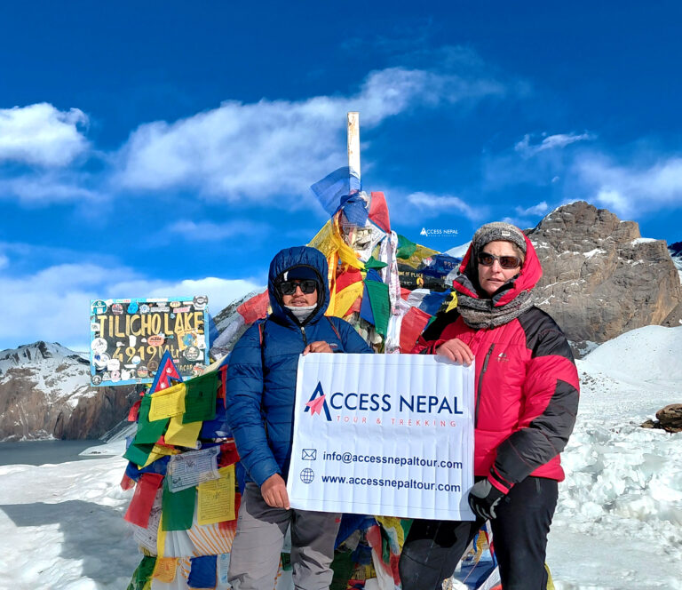
Annapurna Circuit Trek with Tilicho Lake - 18 Days
 5,416m/17,769ft
 Challenging
 All
Inclusive Plan
All
Inclusive Plan
One of the interesting parts about the Annapurna Circuit Trek with Tilicho Lake is its circular route, meaning it goes in a loop and you won’t see the same scenery twice. Hence, the map of the Annapurna Circuit plays an even more of bigger role than expected.
The Annapurna Circuit Trek was only open for foreigners in 1977. Since then, the Annapurna Circuit map has been one of the most searched trekking maps on the internet.
Following the standard Annapurna Circuit Trek Itinerary at Access Nepal Tour and Trekking, here is a breakdown of the Annapurna Circuit route map:

Annapurna Circuit Trek Route Map
Day 1: Arrival in Kathmandu
The Annapurna Circuit Map officially follows your journey starting from arrival in Kathmandu. Access Nepal Tour and Trekking team’s representative will greet you at the Tribhuvan International Airport and escort you to your hotel in a private vehicle. In the evening, a welcome dinner at a traditional Nepalese restaurant awaits you. You will get a small taste of the unique Nepalese culture and traditions as the welcome dinner will also feature some beautiful cultural performances.
Day 2: Sightseeing in Kathmandu Valley
On your second day of the Annapurna Circuit Trek, you will visit four of Kathmandu’s seven UNESCO World Heritage Sites. The trip includes visits to Pashupatinath, a sacred Hindu temple located at the heart of Kathmandu. Next, you will visit Boudhanath, famous for its massive white stupa with a golden pyramid top and pointed eyes. Then, a visit to Kathmandu Durbar Square, famed for its intricate wooden and stone architecture, and finally Swayambhunath, a Buddhist stupa perched on a hilltop. For a more detailed cultural exploration adventure, trekkers can always choose the Kathmandu Tour package we provide at Access Nepal Tour and Trekking.
Day 3: Drive from Kathmandu to Besisahar
The Annaourna Circuit Map follows a scenic drive from Kathmandu to Besisahar. You will drive along the Kathmandu-Pokhara highway through towns and paddy fields, crossing long bridges to reach Dumre. Then, after following the road above the Marsyangdi River, you arrive at Besisahar.

Annapurna Circuit Trek Transportation
Day 4: Drive from Besisahar to Chame
Another day full of driving awaits trekkers to reach Chame. You begin the day driving along the country road, passing through vibrant villages with incredible views of the Himalchuli and Ngadi Chuli. Along this drive to Chame, you will get your first views of Annapurna. The trail then climbs up the Manang Valley, then following a series of ups and downs, you arrive at your destination for the night, Chame.
Day 5: Trek from Chame to Upper Pisang
The Annapurna Circuit trekking map continues on the trek from Chame to Upper Pisang. The trek offers a dramatic shift in landscapes and elevation. The distance you will cover is approximately 14 to 15 kilometers and takes around 5 to 6 hours of trekking. Along the trek, you are greeted with beautiful views of snow-capped Lamjung Himal and Annapurna II. Upper Pisang offers a great acclimatization stop for trekkers to get used to the altitude. Trekkers are rewarded with an authentic Tibetan-influenced atmosphere, traditional stone houses, and a stunning monastery that overlooks the valley.

Pisang road connects various places within the Pisang area and the broader Annapurna Circuit trekking route
Day 6: Trek to Ngawal
The next stop on the Annapurna Trek map is Ngawal. The trek covers around 10 kilometers in distance, taking around 4 to 5 hours. The views start to open up more, and you get greeted with incredible views of Annapura II, III, and IV. Ngawal village is a serene Tibetan-influenced settlement located at 3,680m.
Day 7: Trek to Manang
The trail to Manang gently descends from Ngawal, passing through old stupas and traditional houses. Along the way, you will pass through the quiet village of Braga, home to one of the most picturesque monasteries in the region. The Braga Monastery is worth stopping by and exploring along the trek to Manang. Manang is a well-developed village with plenty of teahouses, bakeries, and shops.
Manang is also a major acclimatization stop for trekkers preparing to cross the Thorong La Pass.
Day 8: Acclimatization Day in Manang
Trekkers spend an extra day here in Manang for acclimatization. Trekking slowly and following the necessary steps to acclimatize to high altitude gradually is key when trekking in high-altitude regions. When in Manang, trekkers spend an extra day here hiking a short distance for acclimatization reasons.
Day 9: Trek from Manang to Yak Kharka
Following the Annapurna Circuit Map, the trek from Manang to Yak Kharka marks the beginning of the ascent towards the Thorong La Pass. On the trek, the air noticeably starts getting thinner due to the gain in elevation. Trekkers are advised to walk slowly to adapt to the increasing altitude. Along the way, you come across yaks and horses grazing freely, hence the name Yak Kharka.
Day 10: Trek from Yak Kharka to Thorong High Camp
The Annapurna Circuit trek map follows one of the most adventurous sections of the trek en route to the Thorong High Camp. The trek to Thorong High Camp brings you closer to the highest point of the trek, the Thorong La Pass. The trek covers about 9 to 10 kilometers and typically takes 4 to 6 hours to reach.
Day 11: Trek to Muktinath via Thorong La Pass
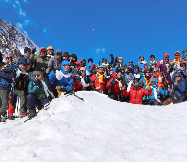
The map of the Annapurna Circuit Trek takes you today to the famous Muktinath Temple, passing through the Thorong La Pass. Crossing the Thorong La Pass is the toughest challenge during the Annapurna Circuit Trek. It is a long hike that takes about 7 to 8 hours, depending on the weather and trail conditions. A large sign marks the high pass, often surrounded by prayer flags and fellow trekkers celebrating their accomplishment.

Thorong La Pass is a mountain pass situated at an elevation of 5,416 meters above sea level.
From the Thorong La Pass, the descent toward Muktinath begins. The descent is long and steep, nearly 1,700 metres. During the descent, trekking poles are highly recommended to protect your knees and prevent injuries. After the steep descent, you will eventually reach Muktinath, a sacred pilgrimage site for both Hindus and Buddhists.
Day 12: Drive from Muktinath to Tatopani
Today, trekkers are up for about a 70 km drive along the country road to Tatopani. The drive takes you through famous areas, including Kagbeni, Jomsom, Marpha, and Ghasa, before reaching Tatopani. Upon reaching Tatopani, trekkers may relax and recover at the natural hot water springs down towards the river. The drive takes you from the dry, desert-like Mustang region into greener valleys, providing scenic views of Mount Nilgiri, Dhaulagiri, and the Kali Gandaki Gorge, the world’s deepest gorge.
Day 13: Trek to Ghorepani
Following your stop at Tatopani, the Annapurna Circuit Map follows the route towards Ghorepani. The ascent towards Ghorepani takes trekkers through terraced farmlands and lush green forests filled with rhododendrons, birch, and magnolia trees.
The village of Ghorepani will be the resting point for the night. The village offers stunning views of the surrounding mountains, including Annapurna I, Dhaulagiri I, Nilgiri, and Tukuche.
Day 14: Trek to Ulleri, Then Drive to Pokhara
On your 14th day of the Annapurna Circuit Trek itinerary, a hike to the Poon Hill viewpoint awaits you. Then the hike down to Ulleri begins. Trekkers find themselves walking through a dense oak and rhododendron forest. Then, you arrive at Banthanti, eventually descending toward Ulleri.
After arriving at Ulleri, trekkers then take on the return drive to Pokhara through the highway, marking the end of the Annapurna Circuit Trek.
Day 15: Drive to Kathmandu
The Annapurna Circuit Trek officially comes to an end today. The drive from Pokhara to Kathmandu follows the scenic Marsyangdi River before merging with the Trishuli River, offering some of the best views of hills, farms, and riverside settlements.
Trekkers also have the option to book a 25-minute flight back to Kathmandu for an additinal charge.
Day 16: Departure from Kathmandu
The Annapurna Circuit Map concludes in Kathmandu. Today, you will depart the city, marking the end of the overall trek.

Annapurna Circuit Trek accommodation
Your standard Annapurna Circuit Trek will follow the basic Annapurna Circuit map and move along the designated routes across various teahouses/lodges along the trek.
The 16-day standard Annapurna Circuit Trek package includes 3 nights at a 3-star hotel in Kathmandu and 12 nights in lodges and teahouses along the trek. During your stay in Kathmandu, the rooms will be on a twin-sharing basis. On the standard package, during the trek, you will stay in teahouses with basic facilities and services, with a shared bathroom. However, private bathrooms are available during your stay in Kathmandu, Pokhara, and Manang.
The Annapurna Circuit Trek is one of the most popular trekking destinations; hence, the accommodation services are good enough for a basic stay as compared to other remote region trekking. Furthermore, you always have the option to improve and customize your stay for an additional cost for a more comfortable trekking experience. The standard route of the circuit is a little different then the Annapurna Base Camp Trek.
Related Packages

Annapurna Sanctuary Trek - 14 Days
- 4,130m/13,550ft
-
Challenging
- All
Inclusive Plan
Annapurna Circuit Trek Food and Beverages
One of the essential parts of the trek is taking proper nutrition. All the Annapunra region packages have standard accommodation, food and beverages like Annapurna Sanctuary Trek and many other packages of this region. Supporting your body during high-altitude ascent is crucial. Meals rich in carbohydrates and proteins are highly recommended. Local delicacies are not only more hygienic but also nutritionally beneficial. Following your Annapurna Circuit Map, you will follow the classical route with stops at teahouses along the way for rest and accommodation. At these teahouses, you will be able to enjoy delightful local dishes, Asian cuisines, and other popular Western food options.
Related Packages
Annapurna Circuit Trek - 16 Days
- 5,416m/17,769ft
-
Challenging
- All
Inclusive Plan
Teahouses provide hygienic meals made from fresh, locally sourced ingredients. A staple dish is the Nepali dish (daal bhat), which includes lentil soup, rice, seasonal vegetables, pickles, meat, and other side dishes. In addition to traditional meals, teahouses also have other options like porridge, macaroni, spaghetti, pizza, lasagna, curry dishes, fried rice, momo (dumplings), sandwiches, Noodles (Chowmein), oats, and bakery items.
The traditional Nepali Dal Bhat comes with an unlimited refill option, making it one of the most popular dishes to consume on the trek.
Due to the location and accommodation type, food and drink prices may vary. We recommend carrying protein bars and dried fruits for extra energy.
What is the best time to do the Annapurna Circuit Trek?
When following the Annapurna Circuit Map, trekkers must know about the best time and the trekking season to do the Annapurna Circuit Trek. The overall trek experience is directly proportional to the time you have chosen to do the adventure, best suited for you.
When it comes to exciting times and adventure in the Himalayas, the Spring and Autumn seasons are undoubtedly the best time to do the Annapurna Circuit Trek. Both of these seasons have their own unique charm and offer some of the best favorable conditions for trekking. The blooming forests filled with flowers, clear skies, warm temperatures, and the opportunity for wildlife exploration add an extra beauty to your exploration on the Annapurna adventure.
The Autumn season is known for its mild temperatures for trekking (not too cold, nor too hot), and clear views of the surrounding mountains, creating one of the best conditions for trekking. Furthermore, the festive vibes and atmosphere on the trek during the Autumn season add a unique adventure for trekkers doing the Annapurna Circuit.
How difficult is the Annapurna Circuit Trek?
If you’re thinking of doing the Annapurna Circuit Trek but you’re stuck worrying about its difficulty, don’t worry. This once-in-a-lifetime adventure in the Himalayas is not a challenging trek overall, but is considered a “moderate” level of trek.
Even if you’re a beginner with no prior trekking experience, with the right preparation and awareness, this trek will not be too difficult for you. There is no technical climbing involved in the Annapurna Circuit Trek, making it a beginner-friendly experience. Along the trek, there are plenty of teahouses and lodges offering various services such as meals and accommodation for trekkers to spend their time resting.
However, the Annapurna Circuit Trek is a Himalayan adventure and requires caution during the journey. So, there are some challenging points that you should prepare for before taking on this journey.
Some of those challenges include:
1. Altitude Sickness
Altitude Sickness or Acute Mountain Sickness (AMS) is one of the leading difficulties trekkers have to face during the Annapurna Circuit Trek. Once you start to ascend river 3,000 meters, the risks of Altitude Sickness also gradually increase. One of the highest points of the trek is the Thorong La Pass at 5,416 meters. At such a high altitude, the air starts to get thinner, and a lack of oxygen can cause altitude sickness.
To prevent such dangers, proper acclimatization is key. Trekkers must trek at a steady pace and listen to their bodies. Following proper acclimatization stops can help prevent any risks of altitude sickness.
2. Trek Duration
On the Annapurna Circuit Trek, you will cover approximately a distance of 160 to 230 kilometers. Depending on the chosen route, trekkers will have to trek for about 5-7 hours a day on average.
Walking for such long hours daily can be physically and mentally exhausting. The length of the trek is something every trekker must keep in mind before taking on the adventure.
3. Weather
It is not breaking news that the weather in high altitudes can change rapidly and is almost impossible to predict. The weather is generally more stable during the peak seasons, like Spring and Autumn. However, in the off-season, the weather can change rapidly. The weather can get too cold at higher altitudes, especially during the night.
Trekkers must always be prepared for the sudden change in weather and expect the unexpected. Threats such as floods, landslides, slippery trails, and snowstorms are quite common during the off-season, making it quite difficult for trekking.
4. Remote Area
The Annapurna Circuit Map follows remote region trails in the Himalayas. Facilities such as transportation and infrastructural development are quite limited here. Hence, during the Annapurna Circuit Trekking adventure, you shouldn’t expect many high-end, premium services.
In such remote locations and high altitudes, there are even lower chances of getting hot water for a shower, and trekkers have to pay an additional amount for such services, including Wi-Fi and electricity for charging devices.
Conclusion
The Annapurna Circuit Map is an essential part of the adventure, required for critical planning and navigating Nepal’s most iconic trekking routes. The Annapurna Circuit takes you through different landscapes, vibrant villages, and high mountain passes. A detailed Annapurna Circuit trek map helps ensure you stay on track while not letting you miss out on any of the experiences.
Whether you’re a solo trekker or someone traveling in a group, a physical or a digital Annapurna Circuit Map provides valuable knowledge of distance, elevation, and key locations you must not miss during the Annapurna Circuit Trek. The Annapurna Circuit map with distance helps you estimate your journey and plan your itinerary accordingly. Using an accurate Annapurna Circuit Map not only helps you with planning and logistics, but also enhances your understanding of the majestic Annapurna region.
Ultimately, the Annapurna Circuit trekking map is more than just a navigation tool for trekking. It is a guide for you and your loved ones to explore the beauty of the Annapurna region without missing a thing. Considered one of the most majestic trekking journeys in the world, Annapurna Circuit requires every bit of careful planning and execution to enjoy the adventure fully. After all, safe trekking is what we prioritize at Access Nepal Tour and Trekking.


Awards and Achievements
Access Nepal Tour and Treks has been recognized with TripAdvisor’s prestigious Travelers’ Choice Award for multiple consecutive years, reflecting our unwavering commitment to quality and clients’ satisfaction.


Leave Your Comment